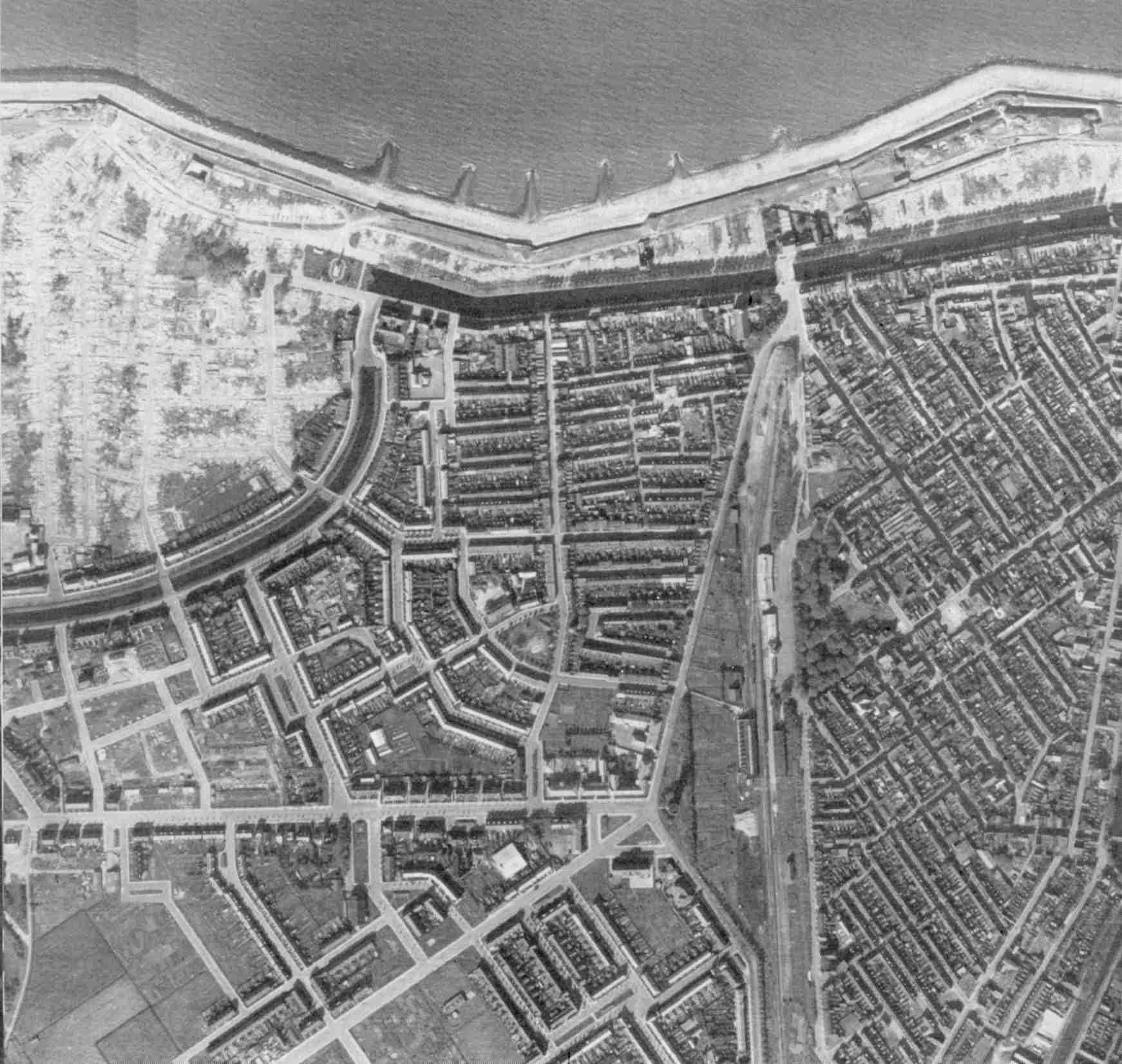
Aerial photograph of the Den Helder demolition zone
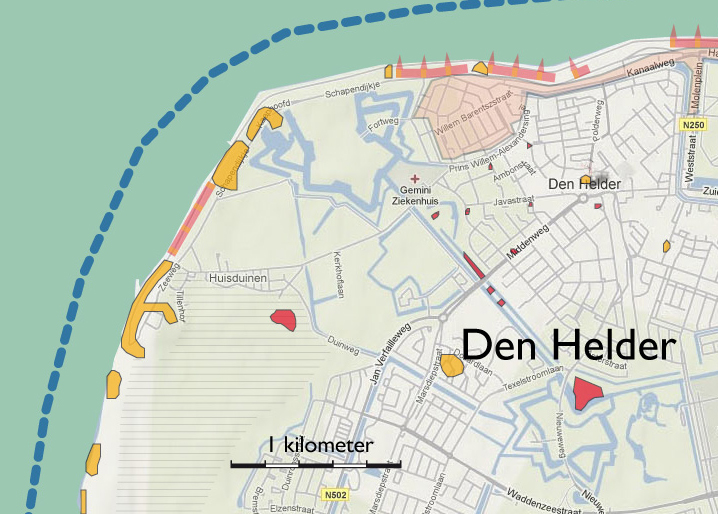
In order to create an unobstructed field of fire, systematic demolition of the Ouwe Helder neighborhood and of a wide swath of housing along the coast to got underway in 1942.
Source: WUR Library, Special Collections
Photograph demolition zone Source: Helderse Historische Vereniging
Dijkstraat 2
The bombardment of 31 October 1941 destroyed part of the construction along the Dijkstraat.
Source: Den Helder Historical Society.
Demolition zone – the Breestraat as seen from the Hartesteeg
400 to 1300 laborers a day were involved in demolition work. A system of fines and rewards was in place to press workers to complete the work within a set time frame. The German Wehrmacht, however, failed to remove reusable building materials and rubble in time, forcing the wreckers to interrupt the activities. The streets were filled with debris with no room to continue work. At times, the rubble in the streets was piled so high that it buried remnants of any walls left standing.
Source: Den Helder Historical Society.
Demolition zone – the Langestraat as seen from the Middenstraat
The Central Bureau for Building Materials [Centraal Bureau voor de Bouwmaterialen] supervised the collection (and confiscation) of all reusable materials from condemned buildings and the redistribution of these materials to the German military command. Leftover rubble – with all undamaged bricks removed – was generously returned to the civilian authorities. And when the city was in need of a small number of roof tiles to repair bomb-damaged residences, the Bureau charged a hefty price.
Source: Den Helder Historical Society.
Original street plan Ouwe Helder
The original Ouwe Helder neighborhood shows a fragmented layout. The whole district was subject to large-scale demolition, turning the area into a barren wasteland.
Source: Den Helder Historical Society
Reconstruction program Oud Den Helder
New plans for the Ouwe Helder district were conceived between 1945 and 1946 by urban planner Wieger Bruin. It was large in scope with straight, rectangular building lots. At its center would be an open space with a large church, intending to foster a village-like character. The housing shortage forced extra units onto the plan, which eventually also included high-rise construction. In the end, the central open space and the church were also sacrificed to allow for more residential construction. Consequently, the neighborhood lost its small-town feel and Wieger Bruin lost his inspiration.
Source: Den Helder Historical Society
Aerial view of the reconstruction
Ouwe Helder, 9 June 1964. In spite of numerous modifications to the reconstruction plan, the original layout of Wieger Bruin’s design is still clearly recognizable.
Source: Den Helder Historical Society
Aerial view of the reconstruction
Ouwe Helder, 12 June 1969.
Source: Den Helder Historical Society


