- Clarification
- Maps
- Present
- Map section IJmuiden - Zandvoort
- Map section Zandvoort
- Map section Waterleidingduinen
- Map section Waterleidingduinen - Zuid
- Map section Zandvoort - Katwijk
- Map section De Zilk

-
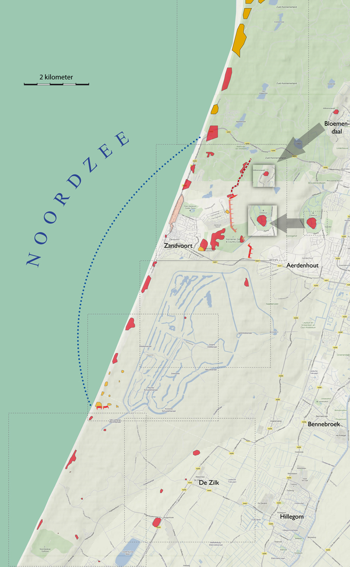
legenda
 Extant German emplacements
 Sea front
 German emplacements no longer present
 Anti-tank wall no longer present
 Anti-tank wall still present
 Demolition zone
 Land front still visible
 Dunes
Dunes


The freely accessible beach north of Zandvoort ended at coastal kilometer marker 72. Beyond it was Stützpunktgruppe Zandvoort territory. This area was enclosed by an uninterrupted anti-tank obstacle that consisted of dunes steepened by excavation, anti-tank walls and canals. The canals function as part of the infiltration area of the “Amsterdamse Waterleidingduinen” [dune catchment area] south of Zandvoort, where rainfall is collected for drinking water. The obstacles ended at the Bloemendaal seaside. The southern land front of Stützpunktgruppe Zandvoort included a special type of passage in the wall, a so-called “Walzkörpersperre”, a roller body barrier.
The Zuidzand coastal battery, several beach defense complexes and two radar posts were located within the confines of the tank obstacle. The Zander radar post, intended to guide German night fighters to their targets, included more than 120 structures of which three were Würzburg Riese-radars and one was a Wassermann-radar. Further to the south was a Renner-radar used by the navy to guide their units.
The Zuidzand coastal battery, several beach defense complexes and two radar posts were located within the confines of the tank obstacle. The Zander radar post, intended to guide German night fighters to their targets, included more than 120 structures of which three were Würzburg Riese-radars and one was a Wassermann-radar. Further to the south was a Renner-radar used by the navy to guide their units.


